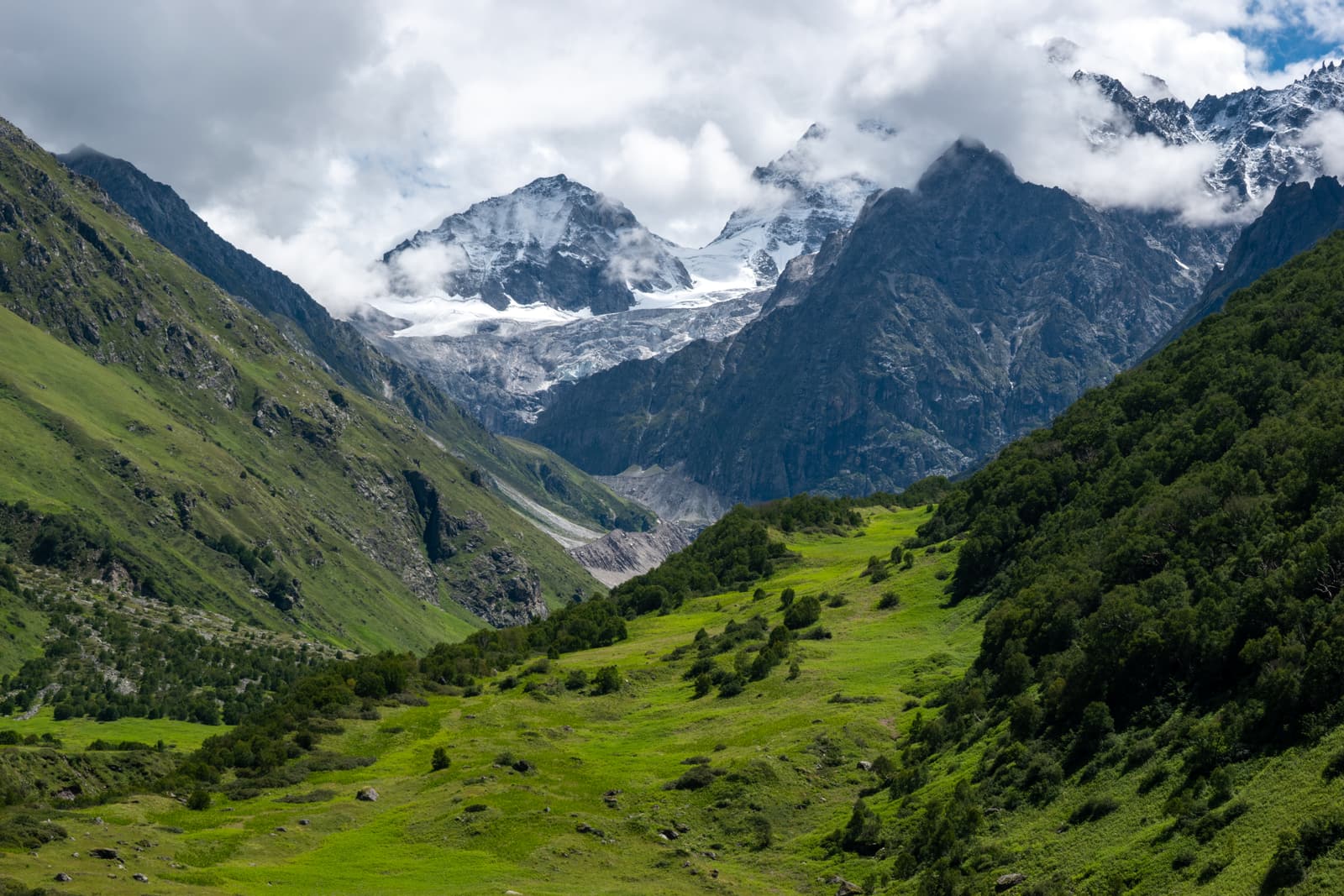
The Valley of Flowers trek is one of the most rewarding moderate treks in the Indian Himalaya, and one of the few great ones that takes place in the monsoon. It has good paths, village lodging and no technical difficulty. What it asks of you is patience with rain, respect for altitude and a schedule with some slack in it.
The trek at a glance
- Where: Chamoli district, Uttarakhand, in the Nanda Devi Biosphere Reserve.
- Season: the park usually opens around 1 June and closes in October; peak bloom is roughly mid-July to mid-August.
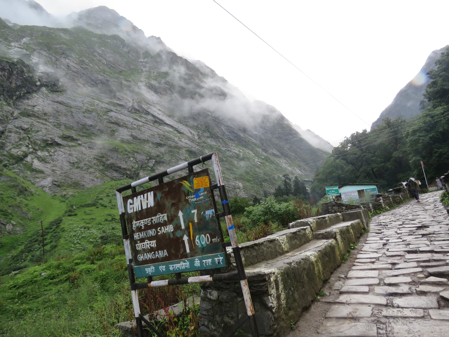
- Base: Ghangaria, about 3,050 m, a 9–10 km walk from the roadhead at Pulna.
- Highest points: the valley floor at about 3,300–3,700 m; Hemkund Sahib at about 4,329 m.
- Grade: moderate. Total walking is around 45–50 km over four days.
- Time needed: six days from Haridwar or Rishikesh, plus a buffer day.
A typical six-day itinerary
This is the plan most operators and independent trekkers follow. It starts and ends in Haridwar or Rishikesh.
| Day | Route | Distance & time | Sleep at |
|---|---|---|---|
| 1 | Haridwar / Rishikesh → Joshimath (or Pipalkoti) | ≈250–275 km by road, 9–11 hours | Joshimath, ≈1,900 m |
| 2 | Joshimath → Govindghat → Pulna by road; trek to Ghangaria | ≈25 km drive + 9–10 km trek, 4–6 hours | Ghangaria, ≈3,050 m |
| 3 | Ghangaria → Valley of Flowers → Ghangaria | ≈8–14 km round trip, 6–8 hours | Ghangaria |
| 4 | Ghangaria → Hemkund Sahib → Ghangaria | ≈12 km round trip, 7–9 hours | Ghangaria |
| 5 | Trek down to Pulna; drive to Joshimath (optional Badrinath & Mana) | 9–10 km trek + 25–115 km drive | Joshimath or Pipalkoti |
| 6 | Joshimath → Rishikesh / Haridwar | ≈250–275 km by road, 9–11 hours | — |
 On the trek
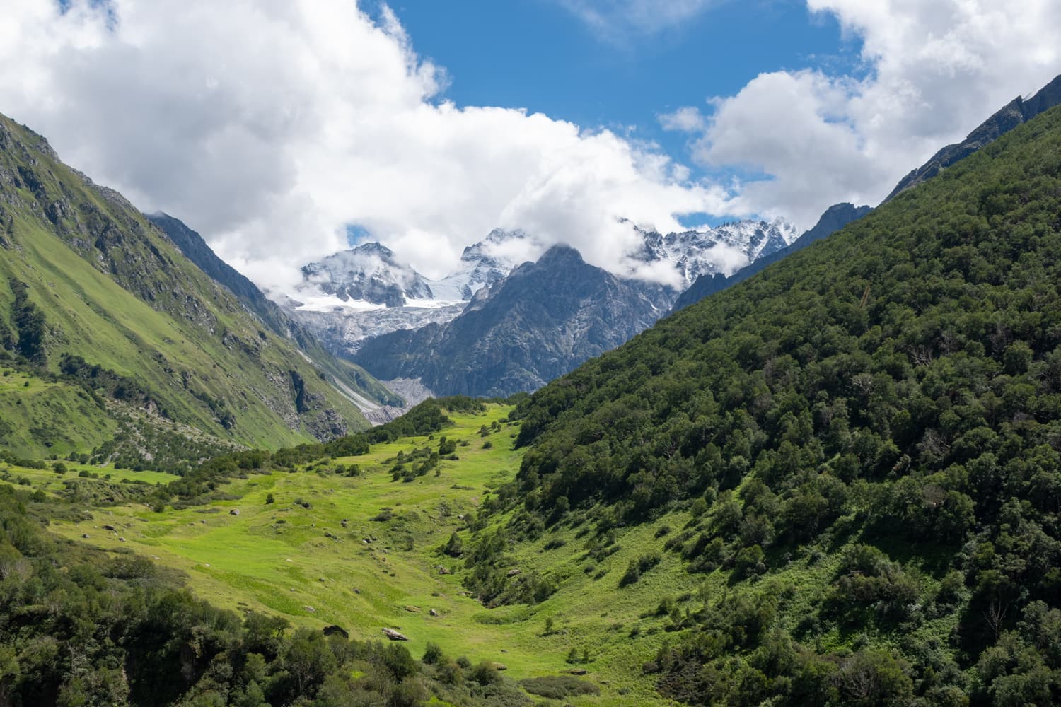
Valley of Flowers National Park
A glacial valley that turns into a garden every monsoon
The park itself: a high valley of the Pushpawati river, roughly 3,300 to 3,700 metres up, where hundreds of species of alpine flowers bloom between June and September. A UNESCO World Heritage Site, open to day hikers only from Ghangaria.
 On the trek
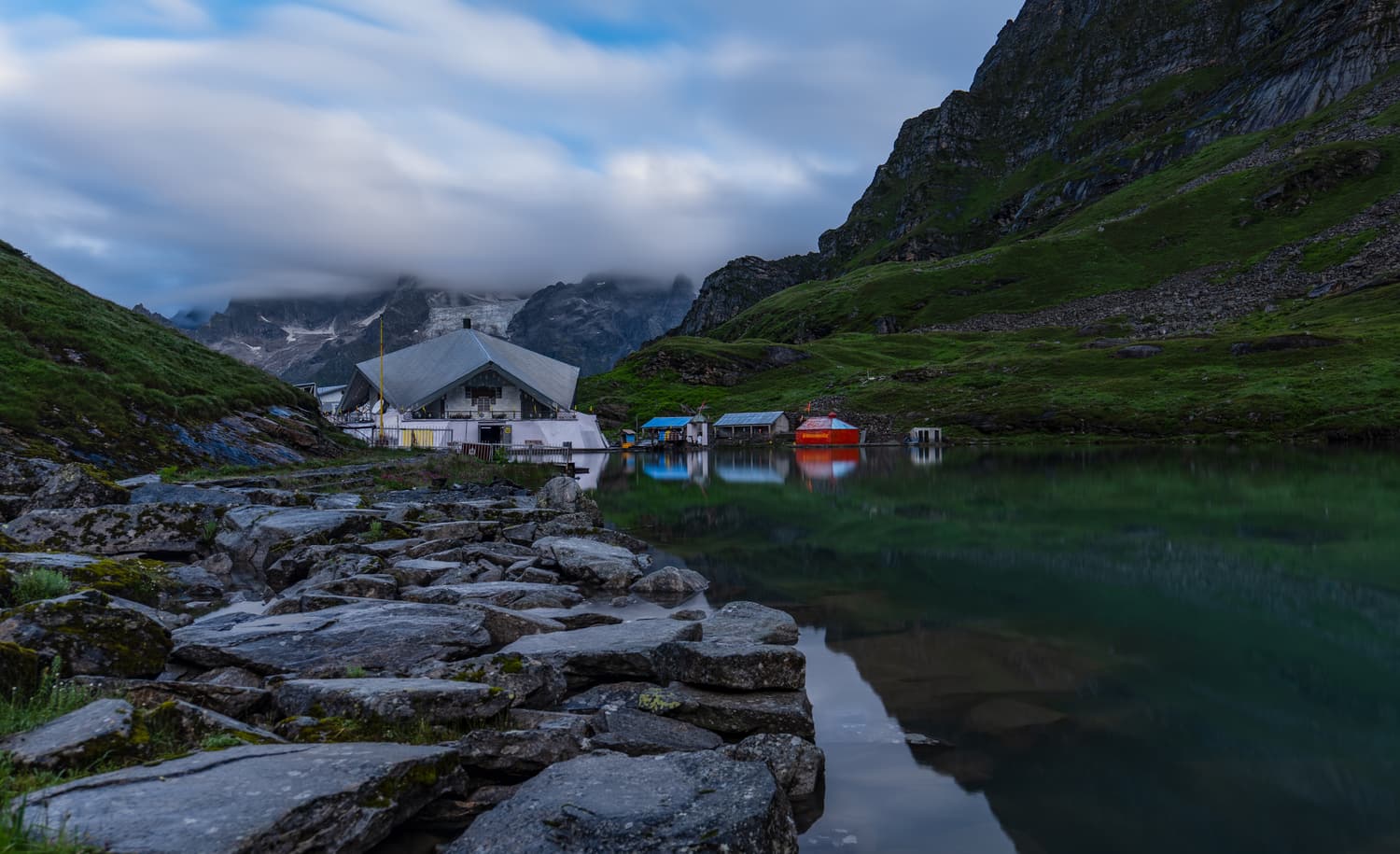
Hemkund Sahib
A Sikh shrine beside a glacial lake at about 4,329 m
One of the highest gurudwaras in the world, set beside a cold, clear lake ringed by seven peaks, with the small Lakshman temple next to it. A steep six-kilometre climb from Ghangaria, lined with Brahma Kamal in late summer.
 On the trek
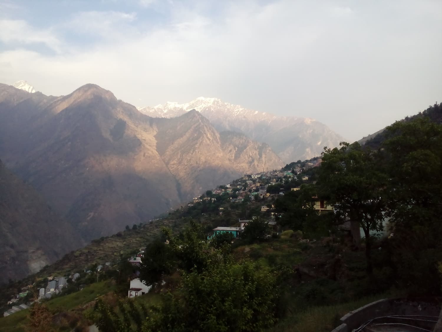 Joshimath & the high valleys
Joshimath (Jyotirmath)
The gateway town above the Alaknanda
The main town of upper Chamoli and the usual overnight halt before the trek: ancient temples, the last dependable ATMs and shops, and the road junction for Auli, Badrinath and Govindghat. Parts of the town were damaged by land subsidence in 2023.
Shorter? Dropping Hemkund Sahib saves one day. Longer? Add a buffer day at Ghangaria, a night at Auli, or a detour via Chopta and Tungnath. A guided package follows much the same outline.
Difficulty and fitness
You do not need trekking experience, but you do need to be able to walk uphill for five or six hours. The day to Ghangaria gains about 1,000 metres; the Hemkund day gains well over 1,000 more and is steep from start to finish. Prepare with a few weeks of brisk walking, stair climbing or jogging. Children and older walkers do the trek every season, often with a mule for the harder sections.
Altitude
Ghangaria is high enough for mild altitude symptoms, and Hemkund Sahib is high enough for real ones. Help your body along: spend the night before at Joshimath, walk slowly, drink plenty of water, avoid alcohol and visit the lower valley before the higher lake. A persistent headache, nausea, dizziness or breathlessness at rest means stop climbing; if it does not improve, go down. Speak to your doctor before the trip if you have a heart or lung condition.
Park rules and entry
- Day visits only. No camping, no overnight stay and no fires inside the national park.
- Gate hours. Entry normally begins around 7 am and stops around midday to early afternoon; visitors must be out by about 5 pm. Hours are posted at the check post and can change.
- Entry fee. Paid at the check post near Ghangaria — a modest charge for Indian citizens and a higher one for foreign nationals, traditionally valid for three days. Check the current rate on arrival.
- No mules in the park. Porters with basket chairs are permitted.
- Leave no trace. No plucking of flowers, no litter, no loud music, and stay on the path. Single-use plastic is discouraged throughout the route.
What to pack
Assume it will rain every day and you will not be disappointed.
- Rain protection: a proper waterproof jacket or a long poncho, a rain cover for your pack, and dry bags or plastic liners for everything inside it.
- Footwear: broken-in trekking shoes with good grip, plus sandals for the evening. Carry spare socks — several pairs.
- Warm layers: a fleece and a light insulated jacket, a warm hat and gloves for Hemkund Sahib and for evenings at Ghangaria.
- Quick-drying clothes: synthetic trousers and shirts; cotton and denim stay wet for days.
- Trekking pole or stick: invaluable on wet stone descents. Wooden sticks are sold cheaply at Govindghat.
- Sun protection: hat, sunglasses and sunscreen — the sun is fierce when it does appear.
- Essentials: a refillable water bottle, torch or headlamp, power bank, personal medicines, a basic first-aid kit, blister plasters and toilet paper.
- Documents and cash: photo ID with photocopies, and enough cash for the whole trek.
Money, ATMs and costs
There are no dependable ATMs beyond Joshimath — none at Govindghat, Pulna or Ghangaria — and very few places take cards or reliable mobile payments once the signal fades. Withdraw what you need in Rishikesh, Srinagar or Joshimath. Budget for rooms and meals at Ghangaria, park entry, jeeps, and any mule, porter or helicopter you may decide on at the last minute. Prices in Ghangaria are higher than in the plains because everything arrives by mule.
Mobile network and power
Coverage is good as far as Joshimath and thins out beyond it. In Ghangaria only some networks work, weakly and not always; there is no signal in the valley and little on the Hemkund trail. Download offline maps, tell someone your plan and expect to be unreachable for two or three days. Electricity in Ghangaria is limited and can fail in storms — bring a power bank.
Leeches, insects and health
Leeches appear in the monsoon on damp, forested stretches at lower altitude, mainly between Pulna and Bhyundar; they are a nuisance rather than a danger. Tuck trousers into socks, carry a little salt and check your ankles at tea stops. Drink bottled, boiled or filtered water, eat freshly cooked food and carry rehydration salts. The nearest proper medical facilities are in Joshimath; first-aid posts operate at Ghangaria in the yatra season.
Safety in the monsoon
- Start every walking day early; afternoons are wetter and the park gate closes.
- Cross streams and any remaining snow bridges with care, and never when the water is rising.
- On the highway, do not travel after dark, and wait out closures rather than trying to squeeze past a slide.
- If the forest department closes the valley for a day because of rain or a damaged bridge, swap your days or use your buffer.
- Consider travel insurance that covers trekking up to 4,500 metres and trip interruption.
Flowers and wildlife
Botanists have recorded several hundred species of flowering plants in the park. The stars include the Himalayan blue poppy, the cobra lily, the Himalayan bellflower, primulas, anemones, geraniums, asters and the tall pink Himalayan balsam that colours whole slopes in August. The Brahma Kamal, state flower of Uttarakhand, grows higher up and is best looked for on the Hemkund Sahib trail. Mammals — Asiatic black bear, musk deer, blue sheep, Himalayan tahr and the elusive snow leopard — keep to themselves, but pikas and the brilliant Himalayan monal are often seen. Our seasonal guide says what flowers when.
A short history
The people of the Bhyundar valley grazed their animals here for generations. The wider world heard of it in 1931, when the mountaineers Frank Smythe, Eric Shipton and R. L. Holdsworth, descending from the first ascent of Kamet, lost their way and came down into a valley full of flowers. Smythe came back in 1937 to botanise and gave the place its English name in his 1938 book The Valley of Flowers. In 1939 Joan Margaret Legge, a botanist from the Royal Botanic Gardens at Kew, died in a fall while collecting plants; her grave is still in the valley. Grazing was stopped after the national park was created in 1982, and UNESCO inscribed the valley as a World Heritage Site in 2005, as an extension of Nanda Devi National Park.
Food and lodging
Ghangaria’s dhabas serve simple vegetarian food — dal, rice, roti, parathas, noodles and endless tea. The gurudwaras at Govindghat and Ghangaria offer free langar meals to all. Rooms are basic; see where to stay for what to expect and where to find comfort on the road.
Responsible travel
- Carry all your litter back to Ghangaria or, better, to Joshimath.
- Refill a bottle rather than buying plastic ones.
- Be kind to mules: do not overload them, and step to the hill side of the path when they pass.
- Hire local guides and porters and buy from village stalls — the season is their whole year’s income.